Ocean mapping, ocean observations in Africa and African ocean information system
sub-themes
I) Ocean mapping in Africa
Much of the ocean is unknown and one of recurring challenge cited is insufficient data to supportthe harnessing of the Ocean economy in Africa. Mapping the Seafloor around Africa is a main theme that UNESCO/IOC Sub Commission for Africa and the Adjacent Island States (IOCAFRICA) is working on for Achieving Comprehensive Seafloor Mapping in Africa by2030.
Much of the ocean is unknown and one of recurring challenge cited is insufficient data to support the harnessing of the Ocean economy in Africa. Mapping the Seafloor around Africa is a maintheme that UNESCO/IOC Sub Commission for Africa and the Adjacent Island States (IOCAFRICA) is working on for Achieving Comprehensive Seafloor Mapping in Africa by 2030.
The UN Decade of Ocean Science for Sustainable Development offers opportunities for partnerships especially in capacity development - focusing on: ocean mapping to meet growing needs of big data analysis and visualization; developing ocean mapping applications that support sustainable blue economy, marine spatial planning and SDG implementation and; strengthening data collection capacities through the deployment of innovative technologies.
How to meet the user-needs with respect to mapping the seafloor;
Ways of enabling knowledge and data sharing in the region and;
The best ways of leveraging on global efforts including Seabed 2030 and the UN Decadeof Ocean Science for Sustainable Development to help efforts for bathymetry mappingaround Africa.
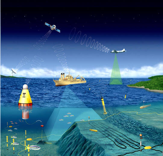
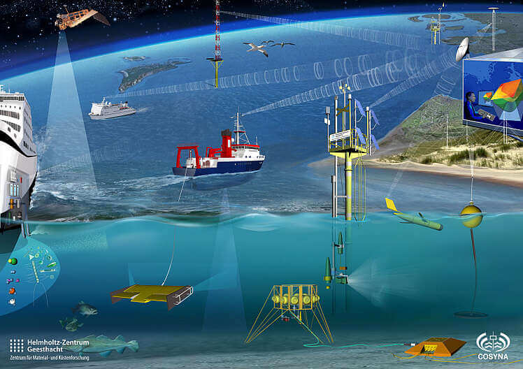
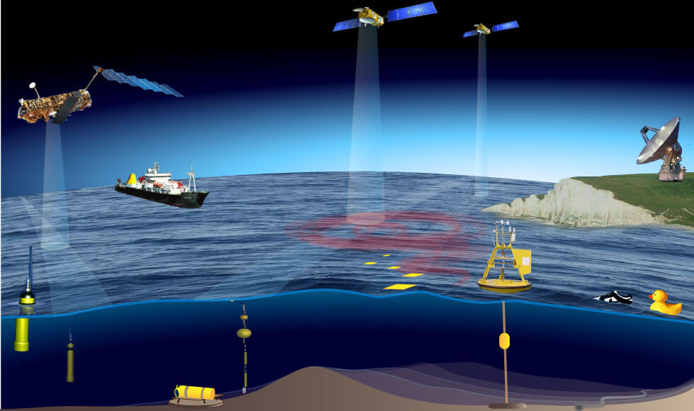
II) Ocean observations in Africa
Global Ocean Observing System is a programme executed by the Intergovernmental Oceanographic Commission (IOC) of the UNESCO, but its success relies on the coordinated contributions of several people and organizations world wide. In the recent years, GOOS has evolved from the conventional approach of solely focusing on global climate to a wider aspect, encompassing operational services and marine ecosystem health, across both open ocean and coastal environments. Subsequently, this initiative has opened multiple opportunities for collaborations—across regions, communities, and technologies—facilitating enhanced engagement in the global ocean observing enterprise to benefit. Scientific knowledge acquired through sustained ocean observations are applied through early warning for ocean-related hazards, climate forecasts and projections,
ecosystem management and assessments and ocean governance.The Elements of the Ocean Mapping and Ocean Observations are:
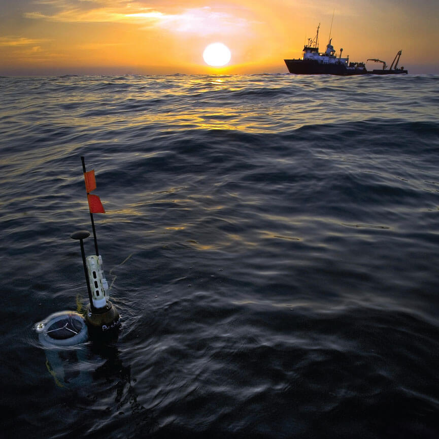
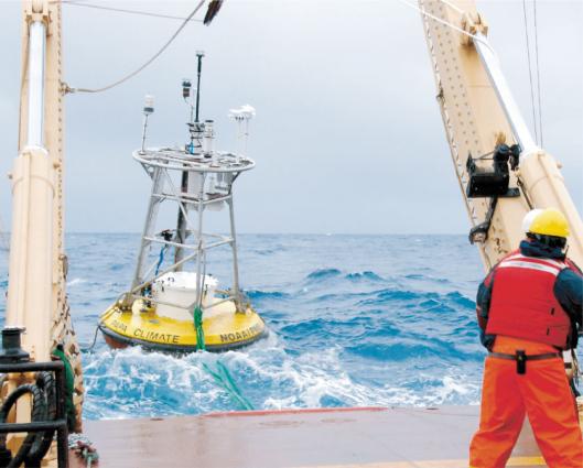
1- Data Buoy Cooperation Panel (DBCP)
The Data Buoy Cooperation Panel (DBCP) is an official joint body of the World Meteorological Organization (WMO) and the Intergovernmental Oceanographic Commission(IOC). It consists of the data buoy component of the Joint WMO-IOC technical Commission for Oceanography and Marine Meteorology (JCOMM) and the Global Ocean Observing System (GOOS). It increases the quantity, quality and timeliness of atmospheric andoceanographic data in ocean areas, to improve global forecasts of weather and ocean conditions, plus also to contribute to climate study and oceanographic research
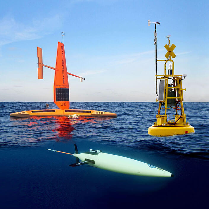
2- Ocean Gliders
The Ocean Gliders program brings marine scientists deploying gliders from all over the world to observe on the long-term physical, biogeochemical, biological ocean processes and phenomena that are relevant for societal applications, allows active coordination and strengthening of the worldwide glider activity.
3- Go-Ship
The Global Ocean Ship-based Hydrographic Investigations Program (GO-SHIP) brings together scientists with interests in physical oceanography, the carbon cycle, marine biogeochemistry and ecosystems, and other users and collectors of hydrographic data to develop a globally coordinated network of sustained hydrographic sections as part of the global ocean/climate observing system. GO-SHIP provides approximately decadal resolution of the changes in inventories of heat, freshwater, carbon, oxygen, nutrients and transient tracers, covering the ocean basins from coast to coast and full depth (top to bottom), with global measurements of the highest required accuracy to detect these changes.
4- Ships of Opportunity
The Ship of Opportunity Program (SOOP) addresses both scientific and operational goals to contribute to building a sustained ocean observing system. The SOOP main mission is the collection of upper ocean temperature profiles and surface measurements, mostly from volunteer vessels.
5- Argo Floats Network
Argo is a global network of more than 3000 free-drifting robots that measure temperature and salinity of the upper 2000 m of the ocean. This allows, for the first time, continuous monitoring of the temperature, salinity, and velocity of the upper ocean, with all data being sent to satellites passing overhead and then made publicly available within hours after collection.
6- Global Sea Level Observing System (GLOSS)
Essential Climate Variables (ECVs): sea level - Long Term Trends (LTT) set of gauge sites,Global core network, altimeter calibration (ALT) set, ocean circulation (OC) set International Data Centres and Archives: Permanent Service for Mean Sea Level, Proudman Laboratory
7- Ship Observation Team
The work of the SOT consists of several very successful and enduring data collection programmes (over 100 years), involving voluntary observing ships and ships of opportunity operated through the VOS and SOOPIP. The individual programmes presently support research, climate forecasting, numerical weather prediction and maritime safety services amongst other applications. The requirements for ocean state estimation applications are rapidly growing. Variables measured basically include surface meteorological observations, plus sub-sets for upper air meteorological and upper ocean physical data. The sampling rationale for these variables has been set via the various scientific advisory groups and Climate related panels Since 2012, UNESCO/IOC through its Sub Commission for Africa and the Adjacent Island States (IOCAFRICA), has worked with its member states to conduct several activities geared towards capacity development, ocean data and information exchange, and ocean observing systems.